وب سایت تخصصی شرکت فرین
دسته بندی دوره ها

Geospatial Data Analyses & Remote Sensing: 5 Classes in 1

سرفصل های دوره

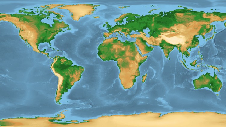
Learn Remote Sensing, QGIS & GIS , main concepts, machine learning, QGIS classification, change detection, Earth Engine


1 - Introduction to the course GIS and Remote Sensing
  • 1 - Introduction to the course
  • 2 - Applications of GIS
  • 3 - Definition of GIS
  • 4 - Applications of Remote Sensing
  • 5 - Definition of Remote Sensing

  • 2 - Software used in this course
  • 6 - About opensource QGIS software
  • 6 - Software-to-use-for-the-course-2019.pdf
  • 7 - QGIS version information
  • 8 - Lab QGIS installation
  • 8 - Practical-1-2.zip
  • 8 - Practical-1-Interface-of-QGIS.pdf
  • 9 - SemiAutomatic Classification Plugin for QGIS
  • 10 - Lab QGIS interface
  • 11 - Lab QGIS Toolbars
  • 12 - OTB installation
  • 12 - OTB-Installation-Guide-udemy-240320.pdf
  • 13 - Lab Creating account in Google Earth Engine

  • 3 - Basics of GIS
  • 14 - Main principles of GIS
  • 15 - Basics of Geodata and its main types
  • 16 - GIS software and your PC set up
  • 17 - Lab Your First GIS Map in QGIS
  • 17 - Materials.zip

  • 4 - Introduction to Remote Sensing theory
  • 18 - Sensors and Platforms
  • 19 - Introduction to digital images
  • 20 - Download-images-SCP.pdf
  • 20 - Lab How to download satellite images with SCP plugin
  • 20 - Practical2-3-sentinel2-sample-1.zip

  • 5 - Practicals basics of satellite image analysis Remote Sensing in QGIS
  • 21 - Lab Layerstacking True and False Colour composites
  • 21 - Landsat5-Image.zip
  • 22 - Lab Image preprocessing atmospheric correction
  • 22 - Landsat-8-orig.7z
  • 23 - Sources of Remote Sensing images
  • 24 - EO browser Using cloud platform for spectral indices & land cover analysis

  • 6 - Basics of land use and land cover LULC mapping theory
  • 25 - Introduction Machine Learning
  • 26 - Understanding Remote Sensing for LULC mapping
  • 27 - Introduction to LULC classification based on satellite images
  • 28 - Supervised and unsupervised image classification
  • 29 - Unsupervised Kmeans image analysis in QGIS
  • 29 - bonn-2019-july-s2.zip
  • 30 - Stages of LULC supervised classification
  • 31 - Overview of image classification algorrithms
  • 32 - Accuracy assessment of LULC map

  • 7 - Practicals Image CLassification in SemiAutomated Classification Plugin in QGIS
  • 33 - LT52300691985196CUB00-MTL.txt
  • 33 - Lab Training data collection in QGIS
  • 33 - Landsat5-Amazon-Rainforest.7z
  • 33 - Landsat5-Image.zip
  • 33 - Training-Landsat5.zip
  • 34 - Lab LULC with the use of spectral angle mapping
  • 35 - Lab LULC with the use of Maximum Likelihood Algorithm
  • 36 - Lab LULC with the use of Minimum Distance Classification Algorithm
  • 37 - Lab Validation data creation
  • 37 - Validation-Landsat5.zip
  • 38 - Lab Accuracy Assessment
  • 39 - Landsat8-class.zip
  • 39 - Landsat-8-orig.zip
  • 39 - Practical-LULC-Landsat.pdf
  • 39 - Project LULC mapping of Landsat 8

  • 8 - Introduction to change detection in QGIS
  • 40 - Introduction to change detection
  • 41 - Change-detection.pdf
  • 41 - Change-detection.zip
  • 41 - Lab Change Detection in QGIS
  • 42 - Lab How to make a map in QGIS

  • 9 - Image Classification in Google Earth Engine
  • 43 - Section Overview.html
  • 44 - Supervised classification with Google Earth Engine explorer
  • 45 - Import images and their visualization in Google Earth Engine
  • 45 - Lab1-GEE-import-data.pdf
  • 46 - Lab2-GEE-kmeans.pdf
  • 46 - Unsupervised Kmeans image analysis in Google Earth Engine
  • 47 - Random Forest Supervised CLassification in Earth Engine
  • 47 - Supervised-classification-RF.txt
  • 48 - Accuracy Assessment in Earth Engine
  • 48 - Accuracy-Supervised-classification-RF.txt

  • 10 - Introduction to Machine Learning in GIS
  • 49 - Introduction to Machine Learning
  • 50 - On Machine Learning in GIS and Remote Sensing
  • 51 - Supervised and Unsupervised Learning classification in GIS and Remote Sensing
  • 52 - Object detection in GIS
  • 53 - Segmentation and objectbased image analysis OBIA
  • 54 - Prediction in GIS and deep learning for Big Data Analysis
  • 55 - Project Machine Learning for GIS on cloud Google Earth Engine

  • 11 - Machine Learning and Objectbased Analysis OBIA in GIS part 2
  • 56 - Section Overview.html
  • 57 - Objectbased image classification OBIA VS pixelbased image classification
  • 58 - OBIA-S2.zip
  • 58 - Object-Based-Classification.pdf
  • 58 - Segmentation of highresolution satellite image
  • 59 - Creating training data from satellite image based on the segmented layer
  • 60 - Objectbased image classification with the Machine Learning algorithm
  • 61 - Final Project Instructions

  • 12 - BONUS
  • 62 - BONUS
  • 62 - Resources-17062020.pdf
  • 139,000 تومان
    بیش از یک محصول به صورت دانلودی میخواهید؟ محصول را به سبد خرید اضافه کنید.
    افزودن به سبد خرید
    خرید دانلودی فوری

    در این روش نیاز به افزودن محصول به سبد خرید و تکمیل اطلاعات نیست و شما پس از وارد کردن ایمیل خود و طی کردن مراحل پرداخت لینک های دریافت محصولات را در ایمیل خود دریافت خواهید کرد.

    ایمیل شما:
    تولید کننده:
    مدرس:
    شناسه: 27643
    حجم: 4466 مگابایت
    مدت زمان: 528 دقیقه
    تاریخ انتشار: ۲۸ آذر ۱۴۰۲
    طراحی سایت و خدمات سئو

    139,000 تومان
    افزودن به سبد خرید