وب سایت تخصصی شرکت فرین
دسته بندی دوره ها

Open source GIS & remote sensing for conservation (Beginner)

سرفصل های دوره

Applied course exploring practical uses of GIS and remote sensing in environment and wildlife conservation.


1. Course introduction
  • 1.1 1.1. Course Introduction.pptx
  • 1. 1.1. Welcome to the course!
  • 2.1 Drones count wildlife more accurately and precisely than humans.html
  • 2.2 What is GIS (ESRI).html
  • 2.3 What is GIS (GIS Geography - also a very useful resource in general).html
  • 2. 1.2. What is GIS
  • 3.1 Hardware requirements for GIS work.html
  • 3. 1.3. Components of a GIS
  • 4.1 QGIS installation instructions.html
  • 4. 1.4. Installing QGIS
  • 5.1 Applications of GIS and RS in Conservation.html
  • 5.2 Connecting the dots mapping habitat connectivity for tigers in central India.html
  • 5.3 Drought in the Horn of Africa - Regional Remote Sensing Analysis.html
  • 5.4 GIS for Wildlife Conservation (Story Map).html
  • 5.5 GPS tracking of wolves in six different packs clearly shows how packs avoid each other.html
  • 5.6 Wildlife monitoring and tracking technology.html
  • 5. 1.5. Applications of GIS and remote sensing in Conservation
  • 6.1 Best open source GIS software.html
  • 6.2 ESRI ArcGIS Non-Profit Program.html
  • 6. 1.6. Why open source
  • 7.1 Quick Map Services Guide (easily add basemaps to QGIS).html
  • 7. 1.7. Getting Started with QGIS
  • 8. 1.8. Reflection activity for Section 1.html
  • 9. 1.9. Section 1 review

  • 2. Basic principles of GIS
  • 1. 2.1. Introduction to section 2
  • 2. 2.2. Spatial data types
  • 3.1 Batch conversion of latlong coordinate format.html
  • 3.2 Convert between decimal-degrees and degrees-minutes-seconds for latlong coordinates.html
  • 3. 2.3. Coordinate reference systems
  • 4.1 Check which UTM zone you are in.html
  • 4.2 Convert between UTM and latlong.html
  • 4.3 More info on the difference between Geographic Coordinate Reference Systems and Projected Coordinate Reference Systems.html
  • 4.4 Wizard to help select a suitable projection.html
  • 4. 2.4. Projected coordinate reference systems
  • 5. 2.5. Which CRS
  • 6. 2.6. Sources of Spatial Data for Conservation
  • 7. 2.7. Basic principles of GIS quiz.html
  • 8. 2.8. Section 2 review

  • 3. Getting started with GIS
  • 1. 3.1. Introduction to Section 3
  • 2.1 Free Online GIS and RS data tools and resources.pdf
  • 2. 3.2. Sourcing data online for conservation applications
  • 3.1 GeoFabrik - use to download data for specific countries or regions.html
  • 3.2 Humanitarian OpenStreetMap (HotOSM) Export Tool - use to download specific feature types for custom AOI.html
  • 3.3 Humanitarian OpenStreetMap (HotOSM) Tasking Manager.html
  • 3.4 OpenStreetMap official website - use to browse maps & download data for small areas.html
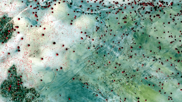
  • 3. 3.2.x. Extra OpenStreetMap
  • 4. 3.3. Adding spatial data to QGIS
  • 5. 3.3.x. Extra Reprojecting Vector Data
  • 6.1 Expressions in QGIS.html
  • 6. 3.4. Extracting data
  • 7. 3.5. Vector Styles and Labels
  • 8.1 NASA Earth Data website.html
  • 8.2 SRTM 30 metre downloader.html
  • 8. 3.6. Downloading a digital elevation model (DEM)
  • 9. 3.7. Raster and DEM Styles
  • 10.1 Best Practices for Map Design ESRI Presentation.html
  • 10.2 Colour Brewer - colour advice for maps.html
  • 10.3 ESRI Map Gallery.html
  • 10.4 Geographers Guide to Types of Maps.html
  • 10.5 Useful link for choosing complimentary colours.html
  • 10. 3.8. Introduction to mapping and cartography
  • 11. 3.9. Creating a publication-quality map in QGIS
  • 12. 3.10. Getting Started with GIS - Quiz.html
  • 13. 3.11. Section 3 review

  • 4. Working with Vector Data
  • 1. 4.1. Introduction to section 4
  • 2.1 boni dodori.zip
  • 2. 4.2. Georeferencing
  • 3.1 Editing in QGIS.html
  • 3. 4.3. Creating new vector data and digitising
  • 4.1 Creating expressions in QGIS.html
  • 4.2 QGIS Field Calculator cheat sheet.html
  • 4.3 Quick reference - field data types.pdf
  • 4. 4.4. Field calculations + calculating feature geometry [e.g. calculate PA areas]
  • 5.1 Session Data.zip
  • 5. 4.5. Summarising + analysing attribute table data [% country area protected]
  • 6.1 Colour Brewer - colour advice for maps.html
  • 6.2 Data classification for choropleth maps.html
  • 6.3 Geographers Guide to Types of Maps.html
  • 6. 4.6. Choropleth Mapping
  • 7.1 Labelling in QGIS.html
  • 7.2 Manually moving labels in QGIS.html
  • 7.3 Rule-based labelling in QGIS.html
  • 7.4 WB Rivers LatAm.zip
  • 7. 4.7. Complex labelling
  • 8. 4.8. Section 4 quiz.html
  • 9. 4.9. Section 4 review

  • 5. Survey design and data collection
  • 1. 5.1. Introduction to section 5
  • 2.1 abundance-distribution-habitat-activity-and-conservation-of-5avuwcrelc.pdf
  • 2.2 Dja great apes Primate Conservation (2022).pdf
  • 2.3 Sampling 2023 RajAmin.pdf
  • 2. 5.2. Ecological survey design
  • 3. 5.3. Creating survey grids and transects in QGIS
  • 4.1 Cyber Tracker app - Google Play link.html
  • 4.2 GPS Tools app - Google Play link.html
  • 4.3 Maps.Me - Google Play link.html
  • 4.4 ODK app - Google Play link.html
  • 4.5 SMART Desktop and mobile app.html
  • 4. 5.4. Ecological survey data collection tools
  • 5.1 Creating an XLS form.html
  • 5.2 Kobo Toolbox - Create an account.html
  • 5.3 ODK manuals.html
  • 5.4 ODK XLS form checker tool.html
  • 5.5 ODK XLSForm CT Survey.xlsx
  • 5.6 WPS Office download (includes free spreadsheet programme).html
  • 5. 5.4.x. Extra Preparing an ODK survey
  • 6. 5.5. Loading sampling points onto a GPS device or Maps.Me on your mobile
  • 7. 5.6. Collecting data in the field on your mobile
  • 8.1 Data cleaning guide.html
  • 8.2 Kobo Toolbox - Managing projects and data.html
  • 8. 5.7. Downloading and cleaning data
  • 9. 5.8. Section 5 quiz.html
  • 10. 5.9. Section 5 review

  • 6. Management and visualisation of Survey Data
  • 1. 6.1. Introduction to section 6
  • 2.1 Amin et al 2019 Sokole Bushy Tailed Mongoose Kenya.pdf
  • 2.2 Google Earth download link.html
  • 2.3 Instructions on importing GPS data into Google Earth.html
  • 2.4 Sokole Camera Traps.zip
  • 2. 6.2. Importing and visualising data in Google Earth
  • 3.1 Boni Aders Duiker TR.csv
  • 3.2 Boni CT.csv
  • 3.3 Download Notepad++ (free text editor).html
  • 3.4 Link to download WPS Office (open source equivalent of Microsoft Office).html
  • 3. 6.3. Importing and joining CSV data [join camera trap locations with trap rates]
  • 4.1 Boni additional data to APPEND.zip
  • 4.2 Boni additional data to MERGE.zip
  • 4. 6.4. Merging and appending features
  • 5.1 Boni CT.zip
  • 5.2 Field Key.txt
  • 5.3 Georgia Kazbegi BoP PC.zip
  • 5. 6.5. Visualising Survey Data
  • 6.1 Comparing interpolation methods.html
  • 6.2 Data Demo1 IDW.zip
  • 6.3 Data Demo2 Heatmap.zip
  • 6.4 FIRMS - download fire data.html
  • 6.5 Interpolation in QGIS.html
  • 6.6 Species distribution modelling - comparison of methods.html
  • 6.7 Spline interpolation in QGIS.html
  • 6. 6.6. Interpolation and hotspot mapping
  • 7. 6.7. Section 6 Quiz.html
  • 8. 6.8. Section 6 review

  • 7. Section 7 Vector Spatial Analysis
  • 1. 7.1. Introduction to section 7
  • 2.1 Buffering.zip
  • 2.2 South Sudans Great Migration.html
  • 2. 7.2. Buffering [create buffer zone around protected area]
  • 3.1 Overlay Tools Data.zip
  • 3.2 Vector Overlay Tools in QGIS.html
  • 3. 7.3. Overlay tools - intersect, union, erase
  • 4.1 Spatial Join Data.zip
  • 4.2 Understanding spatial relationships in GIS.html
  • 4. 7.4. Spatial join
  • 5.1 Research paper from Kenya (Amin et al., 2019) - analysis of distance to forest edge on species occurrence.html
  • 5. 7.5. Nearest Neighbour [details + distance to protected area boundary]
  • 6.1 Boolean overlay in GIS.html
  • 6.2 Reintroducing lynx in the UK.html
  • 6. 7.6. Boolean overlay and suitability analysis [habitat suitability]
  • 7.1 Boolean Overlay Survey Design.zip
  • 7.2 Graphical Modeler in QGIS.html
  • 7. 7.7. Boolean overlay to enhance survey design
  • 8. 7.8. Section 7 quiz.html
  • 9. 7.9. Section 7 Review

  • 8. Final assessment
  • 1. Import chimpanzee survey data and develop a map in QGIS (Final Assignment).html
  • 2. Final session congrats on completing the Beginner course!
  • 139,000 تومان
    بیش از یک محصول به صورت دانلودی میخواهید؟ محصول را به سبد خرید اضافه کنید.
    افزودن به سبد خرید
    خرید دانلودی فوری

    در این روش نیاز به افزودن محصول به سبد خرید و تکمیل اطلاعات نیست و شما پس از وارد کردن ایمیل خود و طی کردن مراحل پرداخت لینک های دریافت محصولات را در ایمیل خود دریافت خواهید کرد.

    ایمیل شما:
    تولید کننده:
    شناسه: 33501
    حجم: 4347 مگابایت
    مدت زمان: 359 دقیقه
    تاریخ انتشار: ۷ فروردین ۱۴۰۳
    دسته بندی محصول
    طراحی سایت و خدمات سئو

    139,000 تومان
    افزودن به سبد خرید