وب سایت تخصصی شرکت فرین
دسته بندی دوره ها

Introduction to Spatial Data Analysis and GIS in R

سرفصل های دوره

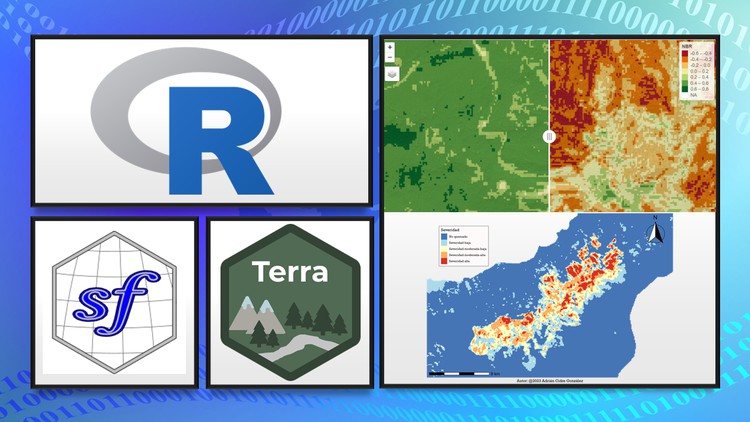
Learn GIS from 0 in R with theory and practice, using sf, terra, mapview, and much more for vector and raster analysis!


1. Introduction
  • 1. Introduction to the course
  • 2. Environment set up (install R, Rtools and RStudio)
  • 3. Rate the course.html
  • 4.1 02 course class.zip
  • 4. Course contents.html
  • 5.1 03 course results.zip
  • 5. Results of the course.html
  • 6. Overview of course contents and packages installation
  • 7. Update packages (recommended, optional).html

  • 2. Introduction to Spatial Data - Theory
  • 1. Module introduction
  • 2. Spatial Data vs Non-Spatial Data
  • 3. Geometry types
  • 4. Simple features
  • 5. QUIZ - Spatial data theory.html

  • 3. Introduction to Spatial Data - Practice
  • 1. Module introduction
  • 2. Data download
  • 3. Exploratory Data Analysis I
  • 4. Exploratory Data Analysis II
  • 5. Convert data frame to spatial object
  • 6. Theory - Vectorial formats
  • 7. Exporting shapefiles from R
  • 8. Importing shapefiles into R
  • 9. ImportingExporting from Geopackage
  • 10. Creating exporatory maps
  • 11. Simple features are tidy data
  • 12. Spatial Properties - Bounding box
  • 13. Spatial Properties - Coordinates and Attributes table
  • 14. Spatial Properties - Geometry type
  • 15. Spatial Properties - Coordinates Z and M
  • 16. Summary of the module

  • 4. CHALLENGE 01 - Introduction
  • 1. Overview of Challenge 01
  • 2. Solution of Challenge 01

  • 5. Coordinates Reference Systems - Theory
  • 1. Module introduction
  • 2. Coordinates Reference System (CRS)
  • 3. Geographic CRS vs Projected CRS
  • 4. UTM Coordinates
  • 5. Projections
  • 6. Codifications for CRS
  • 7. Codifications for geometries
  • 8. Webs of interest
  • 9. QUIZ - CRS theory.html

  • 6. Coordinates Reference Systems - Practice
  • 1. Module introduction
  • 2. CRS in simple features
  • 3. CRS transformation
  • 4. Visualizing in different CRS
  • 5. CRS transformation using proj4
  • 6. CRS transformation on the fly
  • 7. Assign vs Transform the CRS - Common errors
  • 8. Summary of the module

  • 7. CHALLENGE 02 - CRS
  • 1. Overview of Challenge 02
  • 2. Solution of Challenge 02

  • 8. Geometry Operations - Theory
  • 1. Module introduction
  • 2. Spatial predicates
  • 3. Spatial measurements
  • 4. Unary transformations
  • 5. Binary transformations
  • 6. QUIZ - Geometry operations.html

  • 9. Geometry Operations - Practice
  • 1. Module Introduction
  • 2. Working data
  • 3. Predicate functions for counting
  • 4. Spatial Filters I
  • 5. Spatial Filters II
  • 6. Spatial joins
  • 7. Measures - Length
  • 8. Measures - Area
  • 9. Measures - Distances
  • 10. Unary Transformations - Centroids
  • 11. Unary Transformations - Buffer
  • 12. Unary Transformations - Validate geometries
  • 13. Unary Transformations - Simplify geometries
  • 14. Unary Transformations - Voronoi Polygons
  • 15. Unary Transformations - Delaunay Triangulation
  • 16. Binary Transformations - Intersection and Crop
  • 17. Binary Transformations - Difference
  • 18. Binary Transformations - Symmetric Difference
  • 19. Binary Transformations - Symmetric Difference with terra
  • 20. Binary Transformations - Combine geometries
  • 21. Binary Transformations - UnionDissolve I
  • 22. Binary Transformations - UnionDissolve II
  • 23. Summary of the Module

  • 10. CHALLENGE 03 - Geometry Operations
  • 1. Overview of Challenge 03
  • 2. Solution of Challenge 03 - I
  • 3. Solution of Challenge 03 - II
  • 4. Solution of Challenge 03 - III

  • 11. Introduction to Raster Data - Theory
  • 1. Module Introduction
  • 2. Introduction to raster data
  • 3. Raster Fundamentals
  • 4. Analysis of raster data
  • 5. QUIZ - Raster Data.html

  • 12. Introduction to Raster Data - Practice
  • 1. Module Introduction
  • 2. Load working data - Download DEM
  • 3. SpatRaster properties
  • 4. Terrain rasters - Slope, aspect ...
  • 5. Multiband raster
  • 6. Crop and Mask a raster
  • 7. Reclassify continuous rasters
  • 8. Extract values from a raster
  • 9. Arithmetic operations
  • 10. Aggregate a raster
  • 11. Disaggregate a raster
  • 12. Rasters are images
  • 13. Composites - RGB and False Color
  • 14. Calculate NDVI
  • 15. Calculate SAVI
  • 16. Summary of the Module

  • 13. CHALLENGE 04 - Raster
  • 1. Overview of Challenge 04
  • 2. Solution of Challenge 04 - I
  • 3. Solution of Challenge 04 - II

  • 14. Maps with ggplot2
  • 1. Map 01 - Introduction
  • 2. Map 01 - Load data
  • 3. Map 01 - Prepare data and first map
  • 4. Map 01 - Generating Intervals
  • 5. Map 01 - Spanish Population by Municipality
  • 6. Map 01 - Export map
  • 7. Maps 02 and 03 - Introduction
  • 8. Map 02 - Load data and system fonts
  • 9. Map 02 - Install fonts
  • 10. Map 02 - Prepare data
  • 11. Map 02 - Bear Occurrences in Picos de Europa I
  • 12. Map 02 - Export map
  • 13. Map 03 - Bear Occurrences in Picos de Europa II
  • 14. Map 03 - Export map
  • 15. Map 04 - Introduction
  • 16. Map 04 - Load data I
  • 17. Map 04 - Load data II
  • 18. Map 04 - Rivers of Galicia
  • 19. Map 04 - Export map
  • 20. Map 05 - Introduction
  • 21. Map 05 - Prepare data
  • 22. Map 05 - Andean Bear in Peru
  • 23. Map 05 - Export map
  • 24. Map 06 - Introduction
  • 25. Map 06 - Load data
  • 26. Map 06 - Calculate dNBR
  • 27. Map 06 - Reclassify dNBR
  • 28. Map 06 - Tenerife Wildfire Severity
  • 29. Map 06 - Export map

  • 15. Webmaps with mapview and leaflet
  • 1. Webmap 01 - Introduction
  • 2. Webmap 01 - Colors and transparency
  • 3. Webmap 01 - Colour map by variable
  • 4. Webmap 01 - Spanish Population by Municipality
  • 5. Webmap 01 - Export webmap
  • 6. Webmap 02 - Introduction
  • 7. Webmap 02 - Bear in Picos de Europa
  • 8. Webmap 02 - Measurements widget and minimap
  • 9. Webmap 02 - Export webmap
  • 10. Webmap 03 - Introduction
  • 11. Webmap 03 - Galicia Rivers
  • 12. Webmap 03 - Export webmap
  • 13. Webmap 04 - Introduction
  • 14. Webmap 04 - Andean Bear in Peru
  • 15. Webmap 04 - Export
  • 16. Webmaps 05 and 06 - Introduction
  • 17. Webmap 05 - Tenerife Wildfire (synchronized)
  • 18. Webmap 05 - Export webmap
  • 19. Webmap 06 - Tenerife Wildfire (side by side)
  • 20. Webmap 06 - Export webmap
  • 139,000 تومان
    بیش از یک محصول به صورت دانلودی میخواهید؟ محصول را به سبد خرید اضافه کنید.
    افزودن به سبد خرید
    خرید دانلودی فوری

    در این روش نیاز به افزودن محصول به سبد خرید و تکمیل اطلاعات نیست و شما پس از وارد کردن ایمیل خود و طی کردن مراحل پرداخت لینک های دریافت محصولات را در ایمیل خود دریافت خواهید کرد.

    ایمیل شما:
    تولید کننده:
    شناسه: 31782
    حجم: 9899 مگابایت
    مدت زمان: 774 دقیقه
    تاریخ انتشار: ۶ فروردین ۱۴۰۳
    طراحی سایت و خدمات سئو

    139,000 تومان
    افزودن به سبد خرید