وب سایت تخصصی شرکت فرین
دسته بندی دوره ها

QGIS – Geographic Information Systems

سرفصل های دوره

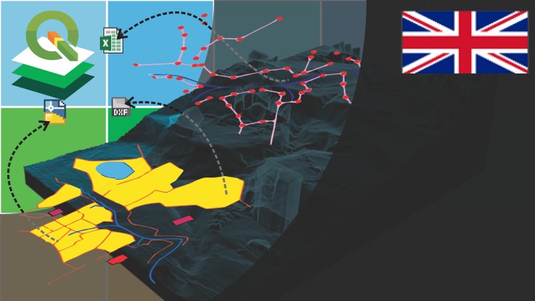
Learn to use QGIS through practical exercises


1 - The basic with QGIS
  • 1 - Lets start with the QGIS
  • 2 - Data selection
  • 2 - SHPtema2.zip
  • 3 - Use bookmarks

  • 2 - Creating and editing spatial data
  • 4 - CSV-World-Cities-TUTORIAL-4.zip
  • 4 - Import data from Excel
  • 4 - World-Cities-TUTORIAL-4.zip
  • 4 - shptema4.zip
  • 5 - Symbology data
  • 5 - shptema5.zip
  • 6 - Editing of attribute data
  • 6 - shptema6.zip
  • 7 - Labeling features
  • 7 - shptema7.zip
  • 8 - Digitization of geographic information
  • 8 - shptema8.zip
  • 9 - Georeferencing of images
  • 9 - imatema9.zip
  • 9 - shptema9.zip

  • 3 - Analysis data
  • 10 - Buffer analysis
  • 10 - shptema10.zip

  • 4 - Publishing contents from QGIS
  • 11 - Map generation
  • 11 - mapa2tema11.zip
  • 11 - shptema11.zip

  • 5 - Lets do it in AulaGEO step by step excercises
  • 12 - Exercise 1 Import CAD data to GIS
  • 12 - model-cad4.zip
  • 12 - model-cad4-2000.zip
  • 12 - shptema1b.zip
  • 13 - Exercise 2 Import coordinates from Excel for split a polygon
  • 13 - coordenadas-ORIGINAL.zip
  • 13 - coordenadas-csv.zip
  • 13 - shp-modificadosT2b.zip
  • 13 - shp-originalesT2b.zip
  • 14 - Exercise 3 Calculation of areas and composition of calculated fields
  • 14 - shp-originalesT3b.zip
  • 14 - shp-projectT3b.zip
  • 15 - Exercise 4 Buffer Analysis
  • 15 - shp-modificadosT4b.zip
  • 15 - shp-originalT4b.zip
  • 16 - Exercise 5 Attribute labeling
  • 16 - shapes-originalesT6b.zip
  • 17 - Exercise 6 Thematization by attributes
  • 17 - PROPIETARIOS.zip
  • 17 - PROPIETARIOS-csv.zip
  • 17 - shapesT8b.zip
  • 18 - AUTOCOMPLETAR.zip
  • 18 - Exercise 7 Digitization tricks
  • 18 - shapesT7b.zip
  • 18 - shapes-modificadoT7b.zip
  • 19 - Exercise 8 Gereferencing images
  • 19 - GEORREFERENCIAR.zip
  • 19 - imagen-georreferenciadaT5b.zip
  • 19 - imagen-originalT5b.zip
  • 19 - puntos-coordenadas.zip
  • 19 - shapes-originalT5b.zip

  • 6 - Asked lesson from students
  • 20 - PyGIS introduction Python from QGIS
  • 21 - Configure a style file for Geoserver from QGIS
  • 22 - Publish a map using Qgis2Web
  • 23 - Adding to QGIS a service published by ESRI ArcGIS Pro
  • 45,900 تومان
    بیش از یک محصول به صورت دانلودی میخواهید؟ محصول را به سبد خرید اضافه کنید.
    خرید دانلودی فوری

    در این روش نیاز به افزودن محصول به سبد خرید و تکمیل اطلاعات نیست و شما پس از وارد کردن ایمیل خود و طی کردن مراحل پرداخت لینک های دریافت محصولات را در ایمیل خود دریافت خواهید کرد.

    ایمیل شما:
    تولید کننده:
    شناسه: 249
    حجم: 1925 مگابایت
    مدت زمان: 162 دقیقه
    تاریخ انتشار: 22 دی 1401
    طراحی سایت و خدمات سئو

    45,900 تومان
    افزودن به سبد خرید